Children's Plaza & Urban Regeneration Proposal
Urban Design
An academic urban design and landscape project developed at multiple scales, from the analysis of the Rapadura Creek subwatershed to the detailed design of a public-space intervention. The project addresses environmental, mobility, housing, and public-space challenges through a broader urban strategy, followed by the development of a Children's Plaza within a selected focus area.
Site Analysis & Urban Strategies
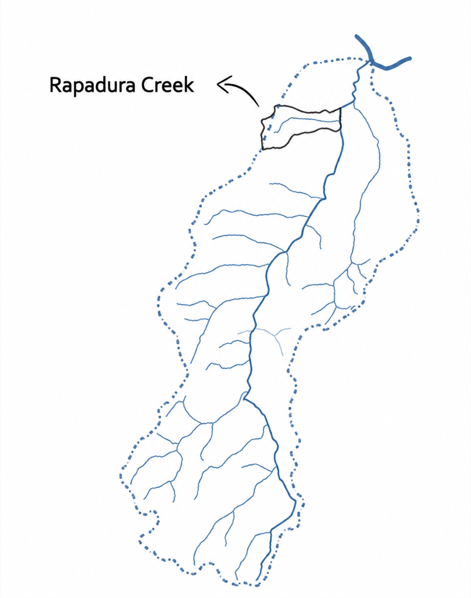
The project began with an analysis of the Rapadura Creek subwatershed, part of the broader Aricanduva River watershed. Mapping, site data, and field observations identified key challenges related to flooding, informal settlements in environmentally vulnerable areas, limited pedestrian and active transportation connections, and underused sites.
In response, a series of urban strategies was proposed to support creek restoration, improve connectivity, introduce new public and community spaces, and address housing and environmental conditions across the study area.
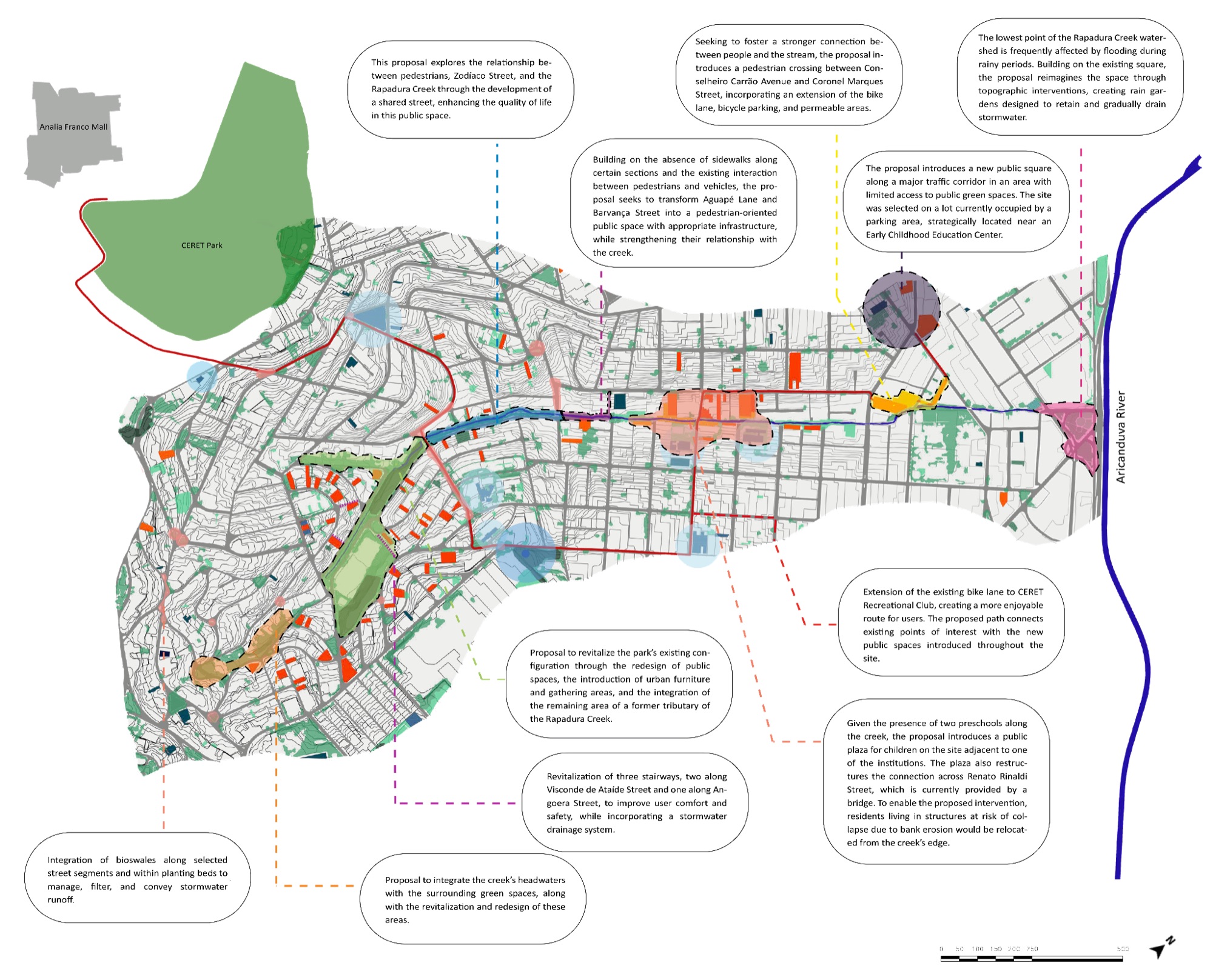
Urban Interventions
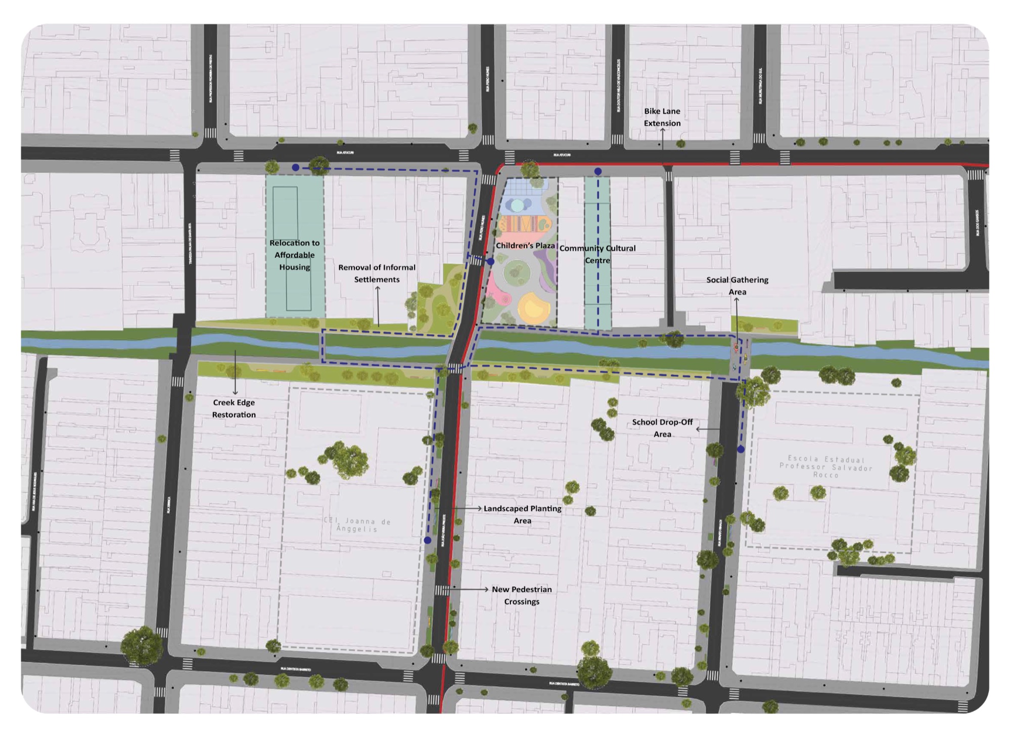
A smaller area along the Rapadura Creek corridor was selected to explore the proposed strategies at the neighbourhood scale. Interventions include creek-edge restoration, relocation of informal settlements to proposed affordable housing, new pedestrian crossings and cycling connections, streetscape improvements, community facilities, and a network of connected public spaces.
The focus-area plan establishes relationships between the creek, surrounding streets, schools, housing, and community uses, creating a framework for the further development of a selected public-space intervention.
Children's Plaza
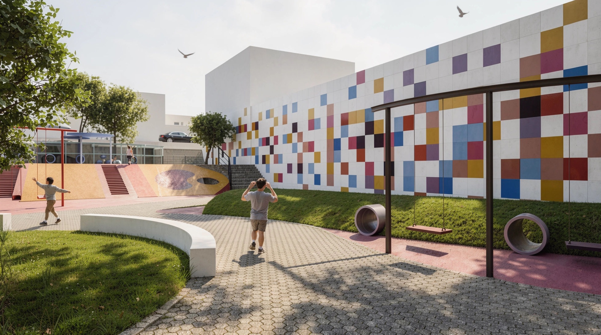
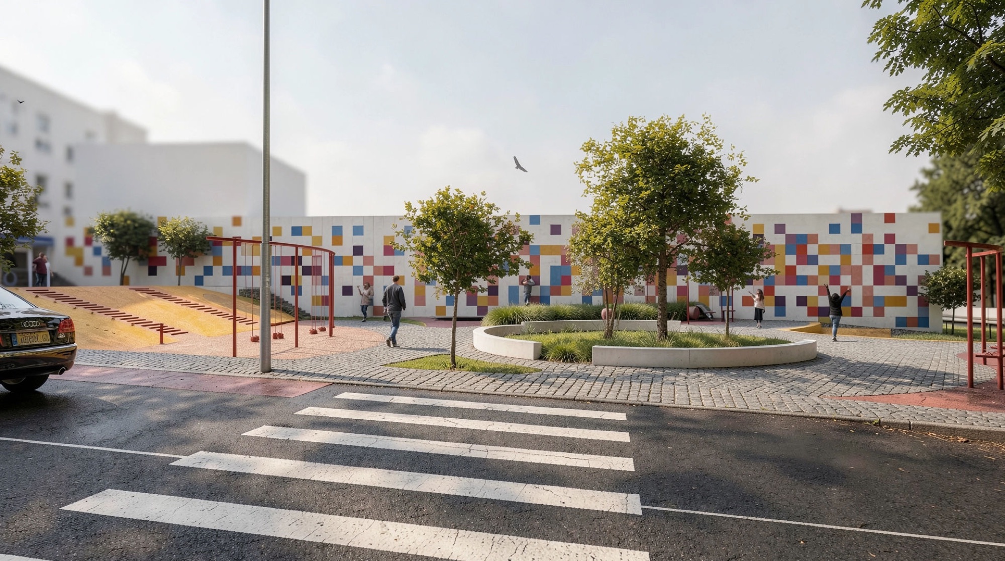
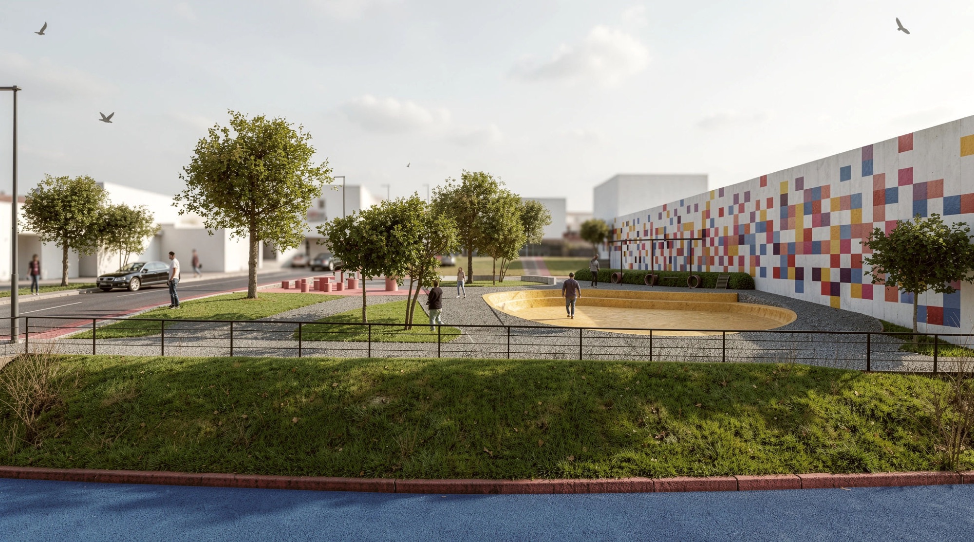
The Children's Plaza was selected for further design development within the focus area. Located near the creek and surrounded by residential areas, two schools, and a childcare facility, the plaza provides a new community space while strengthening connections to the surrounding pedestrian network.
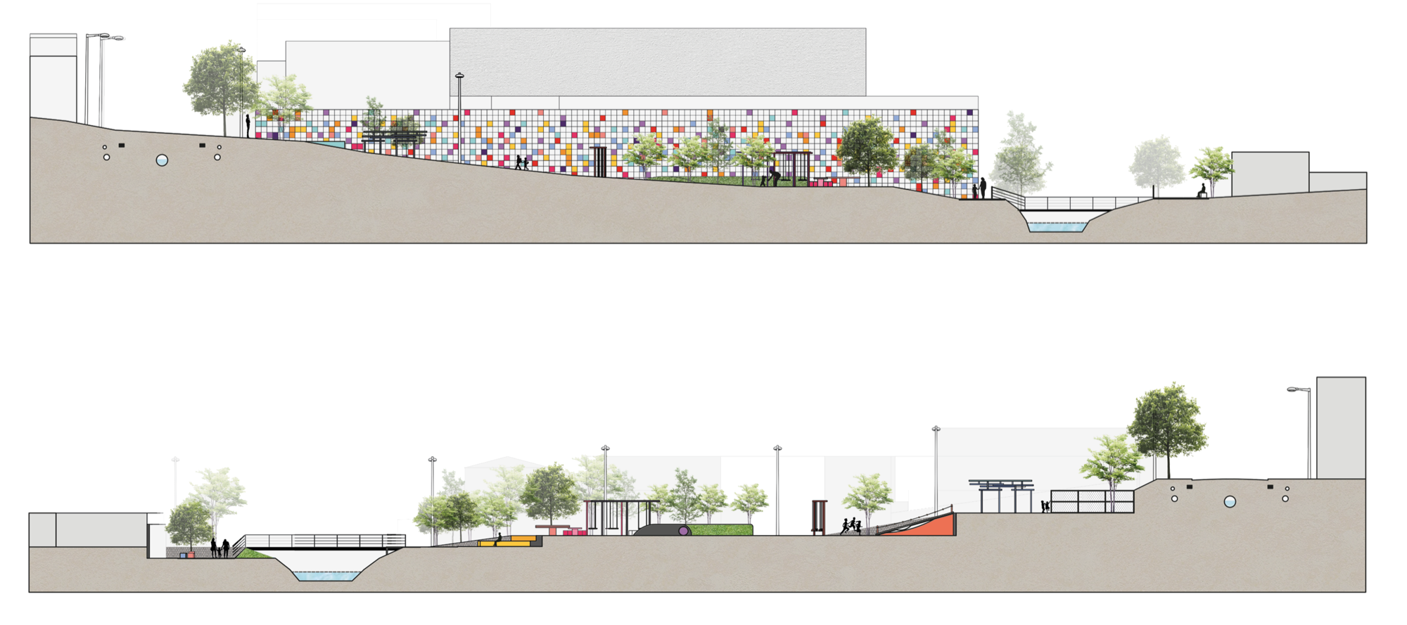
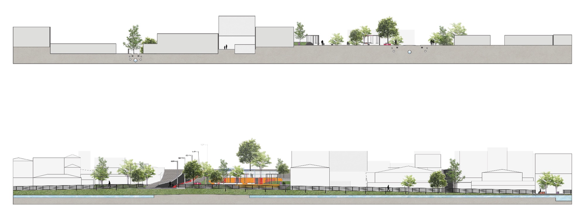
The design responds to the existing topography and vegetation, organizing a series of play, recreation, gathering, and landscaped areas for different age groups and activities.
Plaza Program
The plaza is organized into five areas according to age group and activity, integrating play, recreation, social interaction, and rest.
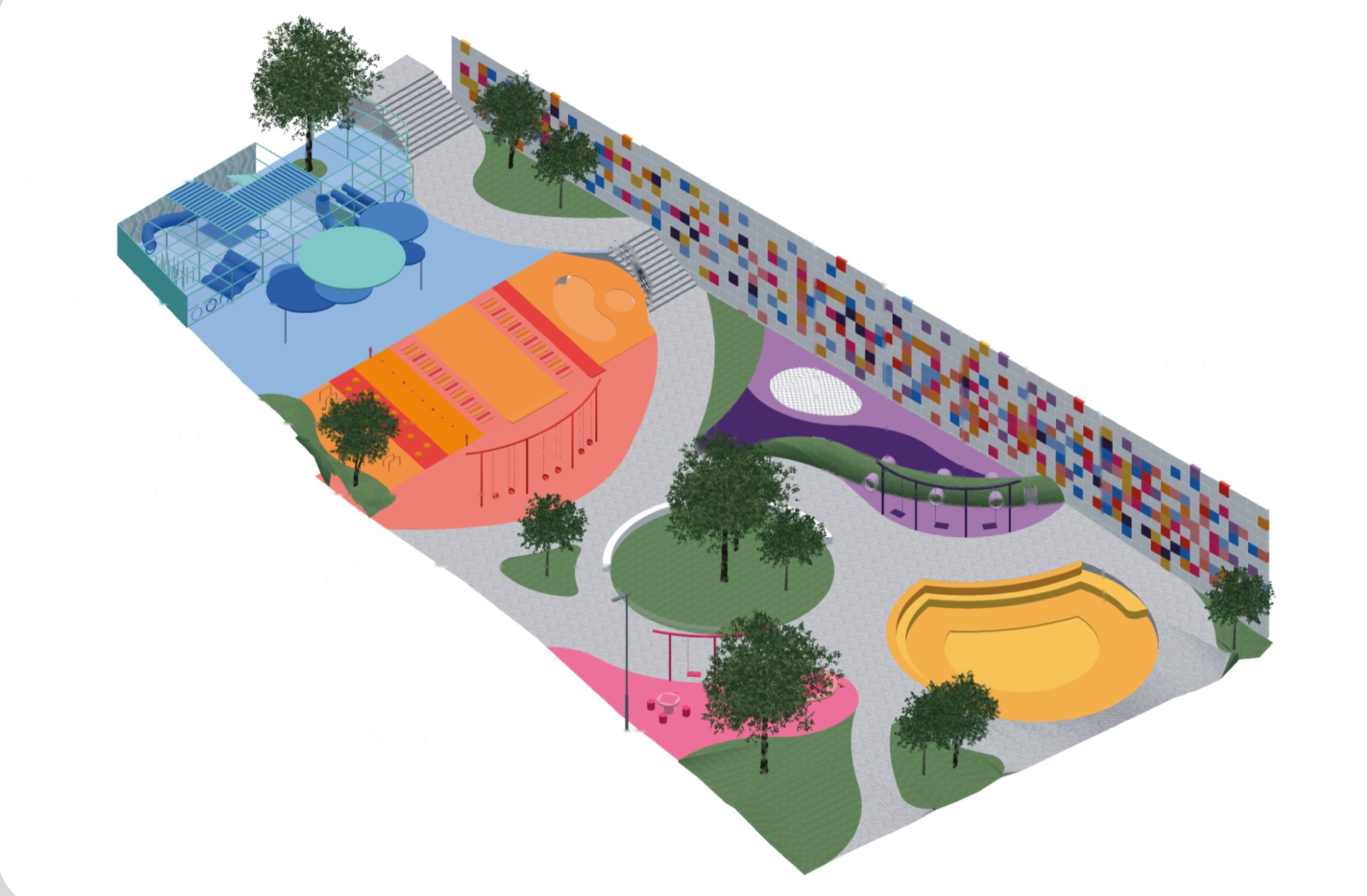
 Children's Play Area
Enclosed play area with tunnels, mazes, interactive elements, preserved trees, and shaded spaces.
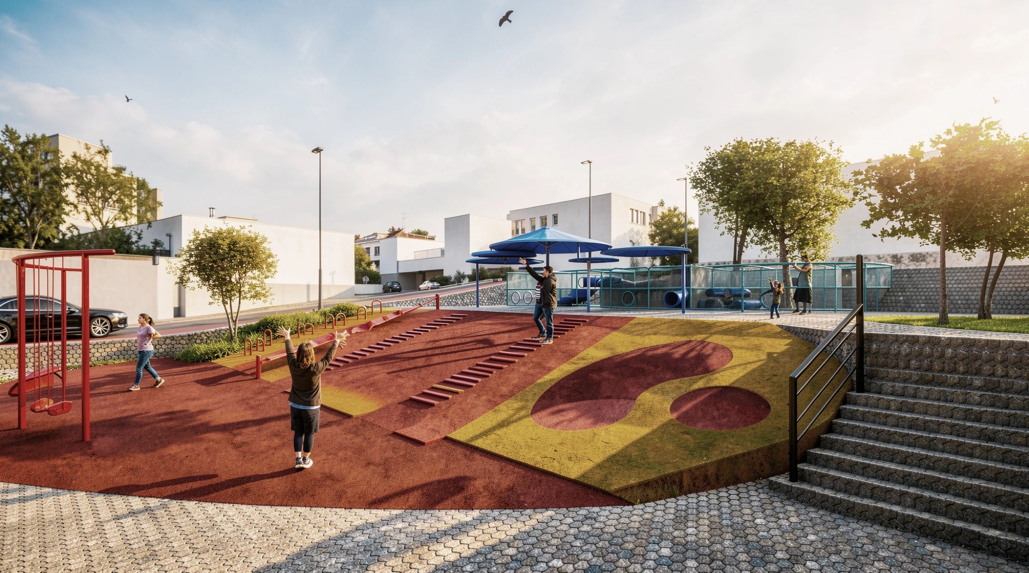
 Topographic Play Area
Slope-integrated play area with slides, climbing elements, stairs, hammocks, and swings across a two-metre grade change.
 Older Children's Play Area
Raised platform with tunnels, swings, an in-ground trampoline, and integrated planting.
 Games & Recreation Area
Flexible social space with table tennis, swings, and fixed seating for board and card games.
 Gathering & Rest Area
Adult and caregiver gathering space with stepped seating and an integrated water feature.
Technical Drawings
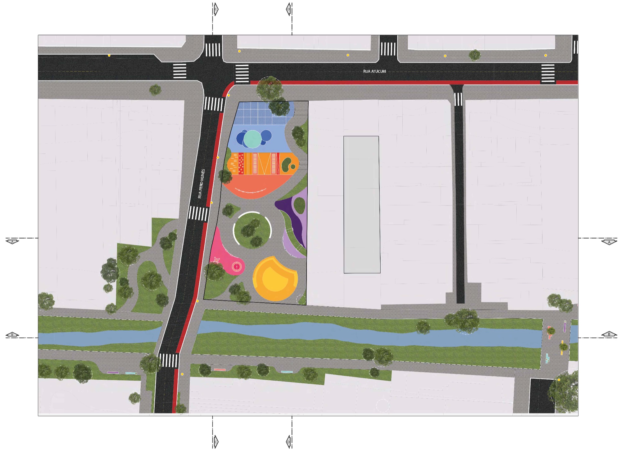 Site Plan
Sections
Final Views